
If you’ve ever searched for a restaurant on your smartphone app or typed in a location on Google Earth, you’ve used a Geographical Information System or GIS.
What started out as mainly a geographer’s tool continues to grow as real-world applications are created to support various industries such as business, education, government, public safety, health care, and transportation.
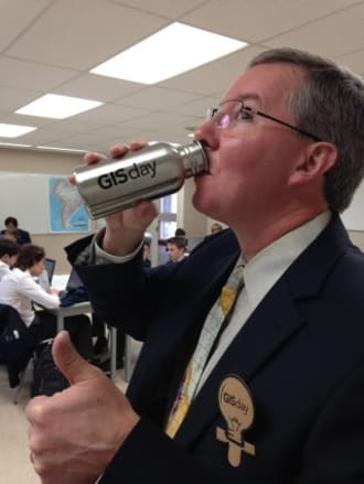
On November 19, mid-way in Geography Awareness Week, SAC joined the international celebration for this technology by participating in GIS Day.
Students in the Middle School completed GIS activities in their geography classes, and a GIS-Day water bottle went to the top student in each section. GIS-Day bracelets and GIS-Day ruler/bookmarks were provided to grade 9 and Middle School students in honour of the event. Receptionists and office staff were also provided with bracelets or bookmarks to help spread the word about GIS.
David Joiner’s grade 9 geography participated in the world’s biggest geography investigation of its type: the Geography World Record collaborative mapping and analysis project organized by the Royal High School, Bath, and supported by Esri UK and the Girls' Day School Trust.
After reviewing the nature of GIS via a story map, quality of life survey data was entered by students for their home sites. Students were then able to use an analysis web app to ask questions about the submitted data. In total, 11,800 people from around the world took part.
“It was interesting to see the SAC-student contributions popping up across the global map from Korea, China, Russia, Ireland, Mexico and Canada,” said Dr. Joiner.
Grade 9 and 12 geography students also participated in a second collaborative map sponsored by Esri that allowed them to take a picture of their view—from their home, classroom or office—and share it with the world, explaining what makes their view unique or different. Faculty, staff and friends of SAC were also asked to share their view and tell what makes their place—their geography—special.
“It was great fun and a wonderful learning experience,” said Dr. Joiner. “These computer mapping skills are transferable across many subjects and activities, and we are looking forward to our participation in GIS Day again next year!”
Story by Cindy Veitch, St. Andrew's College
